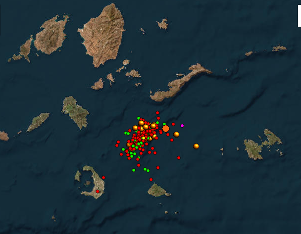
Santorini and Amorgos have recently experienced hundreds of earthquakes over an extended period. Magnitudes of up to 5.4 on the Richter scale have been recorded.
The intense seismic activity has prompted authorities to declare the islands in a state of emergency. As a precautionary measure, schools have been ordered to remain closed until further notice. Residents are advised to avoid large gatherings in enclosed spaces and to stay away from certain built-up areas and ports. If stronger tremors occur, residents should also avoid cliff areas and stay away from the coast.
Seismologists emphasize that the current activity is not linked to historical events such as the devastating 1956 earthquake or the volcano at Santorini. Experts are closely monitoring the ongoing tremors, and authorities urge caution while discouraging speculation about larger events.
However, the ongoing tremors serve as a reminder of the forces constantly at play in the Aegean region, where the Eurasian and African tectonic plates are pushing against each other.
For those living on Santorini and Amorgos or with a deeper knowledge of the Aegean Sea’s history, the recent tremors evoke memories of past earthquakes that forever altered the islands. One of the most devastating in modern times occurred in the mid-20th century, leaving deep scars in its wake. On Santorini, 500 buildings were destroyed and over 3,200 damaged, while 54 people lost their lives. On Amorgos, the destruction was extensive, though documentation of the damage remains limited.
The dual catastrophe – the earthquake and the tsunami – left an indelible mark on Greece’s modern history and serves as a reminder of the Aegean Sea’s relentless seismic forces.
🧭 The Expedition is expanding – but needs more wind in its sails 🌊
For two years, Greek Expedition has explored and shared a different Greece – through stories, guides, and insights created without ads, sponsors, or paywalls.
Everything you see has been created only through personal funding, powered by curiosity and a passion for exploration, discovery, and sharing. That’s how we’ve stayed true to our course: in-depth, personal, and uncompromising in quality.
If you feel our work brings value, help the wind fill our sails and carry the Expedition further – toward new shores.
🙏 Every contribution, large or small, truly helps:
- PayPal: paypal.me/georgesxyftilis
- IBAN: SE98 3000 0000 0058 0828 9473
- Swish (Swedish supporters): 0722 029 786 – Georges Xyftilis
Devastation in the Aegean Sea – the 1956 earthquake
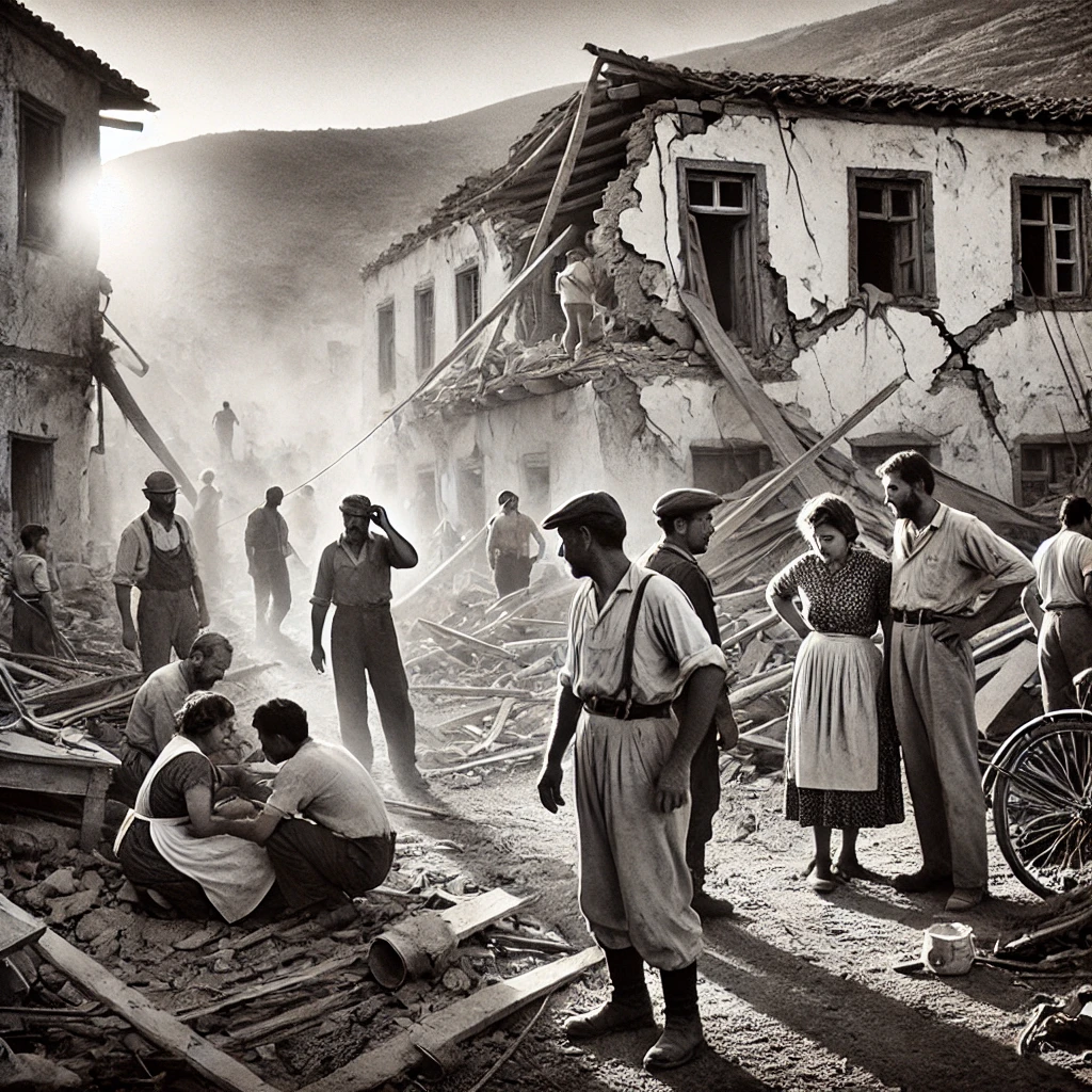
Early morning on July 9, 1956, the earth split open beneath the feet of residents in the heart of the Aegean Sea. The tremors were brutal, but it wasn’t just the quake that left indelible scars on the landscape – it was the tsunami that soon struck, the falling rocks, and the shock that became forever etched in the memories of those who experienced the catastrophe.
The earthquake’s epicenter was located south of Amorgos, the easternmost of the Cycladic Islands in the Aegean Sea. It reached a magnitude of 7.5 – one of the highest recorded in Greece during the 20th century. The official death toll rose to just over 50, while hundreds were injured and even more lost their homes and possessions.
📌 Note: The historical images in this article are AI-generated, based on eyewitness accounts, photographic archives, and contemporary descriptions of the events. They are created to provide a visual impression of how the 1956 earthquake and tsunami affected Santorini and Amorgos.
Earth’s Wrath – Seconds of Devastation
The tremors transformed buildings into rubble, and the shock spread far beyond the Cyclades. The seismic tremors affected not just the islands but the entire Aegean region, all the way to the Turkish coast.
The daily newspaper To Vima reported the following day about the scenes of horror that had unfolded in Santorini:
Scenes of terror and panic spread across the stricken Santorini just minutes after the first tremor. Residents fled their homes in panic, rushing through narrow streets in an attempt to reach the beach. Meanwhile, the sound of collapsing houses echoed through the air, accompanied by the deep rumble of earth tremors and black smoke that seemed to rise from the volcano. Dust covered everything, transforming the morning into a nightmare.
Amid the devastation, people fought desperately to save their loved ones. One woman managed to grab her three infants and shield them with her own body as she fled into the street, avoiding the falling stones.

📌 Note: The historical images in this article are AI-generated, based on eyewitness accounts, photographic archives, and contemporary descriptions of the events. They are created to provide a visual impression of how the 1956 earthquake and tsunami affected Santorini and Amorgos.
Others were less fortunate – a café owner became trapped in a doorway and died of suffocation. Elsewhere, a grandmother took her two grandchildren in her arms and managed, stumbling and crawling, to get out unharmed. But the children’s mother, her daughter, lost her life under the rubble.
Six to eight seconds – that’s how long the quake lasted according to initial official reports. A moment that felt like an eternity for those who experienced it. Santorini, already marked by historical catastrophes, was once again struck by devastation. After the main shock, the tremors gradually subsided but continued to be felt for several days. Fearing more quakes, residents stayed outdoors, no one daring to return to their homes.
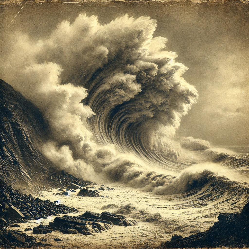
The tsunami – danger approaching from the sea
📌 Note: The historical images in this article are AI-generated, based on eyewitness accounts, photographic archives, and contemporary descriptions of the events. They are created to provide a visual impression of how the 1956 earthquake and tsunami affected Santorini and Amorgos.
As if the earthquake itself wasn’t enough, the next blow came from the sea. A violent tsunami was triggered by the quake and crashed over the islands. Santorini and Amorgos were particularly hard hit. The water masses, with waves up to 30 meters high, swept away houses, boats, and people – those who hadn’t perished in the rubble now had the sea itself to defend against. The waves spread in all directions, affecting not only the southern islands of the Cyclades but also Crete’s northern coast and the Dodecanese Islands.
Historical accounts describe how the sea at Katapola on Amorgos completely withdrew, allowing people to walk on the exposed seabed – before the waves struck back with devastating force.
Rumors about the volcano
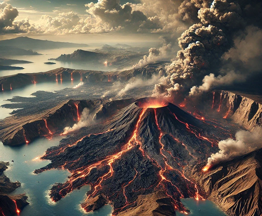
In the first hours of the panic that erupted, many residents reported seeing the volcano erupt, with large amounts of black smoke rising from the crater. However, this turned out to be a misunderstanding.
Seismologists rule out any connection between the earthquake and a volcanic eruption. The tremor was purely tectonic, caused by movements in the Earth’s crust rather than volcanic activity. The presence of the volcano in the area, combined with swirling black dust, may have created the illusion of an eruption, but experts confirm that there is no basis for this claim.
The last confirmed volcanic eruption on Santorini occurred in 1950, six years before the major earthquake, and no unusual seismic activity was recorded at the active craters in connection with the 1956 quake.
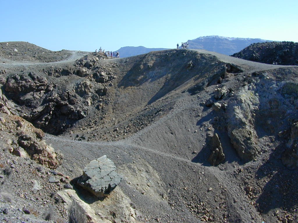
The volcanic history of Santorini
Santorini has experienced numerous volcanic eruptions throughout history, varying in strength and explosiveness. At least twelve major explosive eruptions have been documented, four of which were so powerful that they created a new caldera—meaning a collapse of the volcano’s crater, completely reshaping the landscape.
The oldest eruptions occurred between 650,000 and 550,000 years ago, with many of them taking place underwater. Over the past 360,000 years, the volcano has gone through two major cycles, each culminating in two massive caldera-forming eruptions that reshaped the entire island.
During the Bronze Age, the Minoan eruption of Santorini took place—one of the largest volcanic eruptions in human history. The eruption’s epicenter was located in the area that today forms the great caldera.
Before this event, Santorini had the shape of an almost enclosed ring, with only a narrow passage leading into the inner lagoon. The Minoan eruption was so powerful that large parts of this ring disappeared, creating two new channels and giving the island its present form.
This event was one of the most pivotal in the early history of the Aegean Sea and is believed to have contributed to the decline of the Minoan civilization.
After the Minoan eruption, volcanic activity has been concentrated around the Kameni Islands in the center of the lagoon. These islands have gradually formed since the Bronze Age, with the first one rising above sea level in 197 BCE.
Since then, nine eruptions have been documented. In 1707, an underwater volcano broke through the sea surface, creating Nea Kameni, which has since been the focal point of volcanic activity in the area. During the 20th century, three eruptions occurred, the last one in 1950, with no major consequences.
Although the volcano is considered dormant today, steam and carbon dioxide continue to be emitted from the currently active crater on Nea Kameni, while several older craters remain scattered across the island.
Santorini: The 1925 eruption
Historical footage from the 1925 eruption on Nea Kameni, filmed by Professor Georgios Georgalas. The video was created for educational purposes and includes material from ERT’s documentary series “Ταξιδεύοντας στην Ελλάδα” / “Traveling in Greece”. Published on YouTube by Trantafyllos Soldatos.
The Aegean Sea – where three continents meet
For millennia, the Aegean Sea has carried both life and destruction. Santorini and Amorgos, two islands shaped by the forces of the sea and the earth, have repeatedly witnessed nature’s relentless power.
The hundreds of tremors now shaking Santorini and Amorgos serve as a reminder of the region’s geological reality. For the islands’ inhabitants, earthquakes are not distant historical events but a part of everyday life. Just as the survivors of the 1956 earthquake learned to rebuild their communities, today’s islanders continue to adapt—with modern technology, stronger buildings, and well-developed warning systems. Yet beneath the surface, the forces of nature remain as unpredictable now as they were then.
The most devastating earthquakes
The table below shows the most devastating earthquakes in Greece, ranked by magnitude. The strongest tremors are listed at the top and include the number of fatalities.
| Date | Place | Magnitude (Richter) | Fatalities |
| 12 October 1856 | Rhodos | 8.2 | 618 |
| 16 February 1810 | Kreta | 7.8 | 2500 |
| 26 June 1926 | Rhodos | 7.7 eller 8.0 | 12 |
| 27June 1886 | Filiatra | 7.5 | 326 |
| 9 July 1956 | Amorgos | 7.5 | 53 |
| 4 February 1867 | Kefalonia | 7.2 | 224 |
| 11 August 1903 | Kythira | 7.2 till 8.0 | 14 |
| 12 August 1953 | Argostoli | 7.2 | 476 |
| 9 July 1956 | Rhodos | 7.2 | 18 |
| 19 February 1968 | Agios Efstratios | 7.1 | 20 |
Sources: To Vima, tovima.com, Wikipedia, ekriti.gr, Ta Nea, iefimerida.gr
📌 Note: The historical images in this article are AI-generated, based on eyewitness accounts, photographic archives, and contemporary descriptions of the events. They are created to provide a visual impression of how the 1956 earthquake and tsunami affected Santorini and Amorgos.
Older articles about Amorgos
Amorgos – a gem in the big blue
Amorgos, a future is being built with the stones of older times